
Innovative Web Service Streams Real-Time Weather, Air Quality, and Traffic-Related Air Pollution Data to BREATHE Participant Smartphones
Clients
National Institutes of Health (NIH)
University of California, Los Angeles (UCLA)
University of Southern California (USC)
We designed a modeling system that integrates real-time local weather data with traffic and vehicle emissions data to estimate pollutant concentrations by on-road vehicles. This web service supports pediatric asthma research as well as smartphone/smartwatch applications that provide real-time information and alerts to help children avoid asthmatic incidents.<br>
For each web service request made on a study participant’s smartphone/smartwatch, a unique dispersion model simulation is carried out based on estimated emissions from freeways and major roads within 2 km of the participant’s location. Near-road pollution estimates are combined with regional real-time air quality data from the U.S. Environmental Protection Agency’s AirNow system and the South Coast Air Quality Management District to provide a comprehensive snapshot of a participant’s local exposure to air pollution. The web service also provides real-time weather information at the participant’s location, as specific weather conditions can also be asthma triggers.<br>
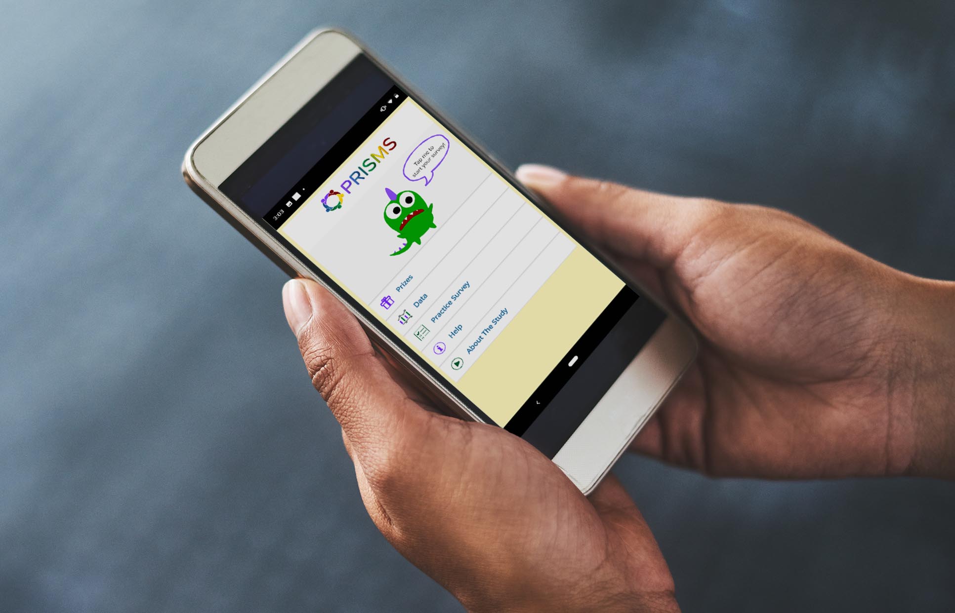
This web service supports the Biomedical REAl-Time Health Evaluation (BREATHE) platform, which was developed by the Medical Imaging Informatics Group at the UCLA David Geffen School of Medicine and other project collaborators to provide a comprehensive framework to address pediatric asthma. The framework standardizes and organizes sensor data, local and regional environmental data, clinical data, and patient-reported activities and outcomes. BREATHE is the focus of the UCLA/NIH Pediatric Research Integrating Sensor Monitoring Systems (PRISMS) Informatics Center.
For each web service request made on a study participant’s smartphone/smartwatch, a unique dispersion model simulation is carried out based on estimated emissions from freeways and major roads within 2 km of the participant’s location. Near-road pollution estimates are combined with regional real-time air quality data from the U.S. Environmental Protection Agency’s AirNow system and the South Coast Air Quality Management District to provide a comprehensive snapshot of a participant’s local exposure to air pollution. The web service also provides real-time weather information at the participant’s location, as specific weather conditions can also be asthma triggers.<br>
This web service supports the Biomedical REAl-Time Health Evaluation (BREATHE) platform, which was developed by the Medical Imaging Informatics Group at the UCLA David Geffen School of Medicine and other project collaborators to provide a comprehensive framework to address pediatric asthma. The framework standardizes and organizes sensor data, local and regional environmental data, clinical data, and patient-reported activities and outcomes. BREATHE is the focus of the UCLA/NIH Pediatric Research Integrating Sensor Monitoring Systems (PRISMS) Informatics Center.
Air Quality
Applied Research
Emissions
Exposure
Health
Modeling
Public Outreach
Transportation

Frederick W. Lurmann

Frederick
W.
Lurmann
Manager of Exposure Assessment Studies
fred@sonomatech.com
/sites/default/files/2023-02/FWLres.pdf