
Visualization of Air Emissions and Surface Meteorology in Southwest Wyoming
Clients
Shell Exploration and Production Company
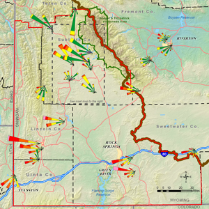
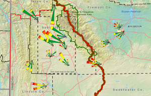
Sonoma Technology provided geographic information (GIS) mapping support for Shell Exploration and Production Company (Shell). Shell was interested in visually displaying air emissions from its oil and gas production facilities and identifying the surface meteorological patterns in Southwest Wyoming. The map products included emissions density maps and site-specific wind roses for the months of February and March, 2004 through 2007, both day and night, in the Pinedale Anticline for Shell’s oil and gas production region.
Air Quality
Emissions
Modeling
Public Outreach
Hilary R. Hafner

Hilary
R.
Hafner
Principal Scientist / Quality Assurance Manager
Hilary@sonomatech.com
/sites/default/files/2025-01/HRHres.pdf